Moulinette
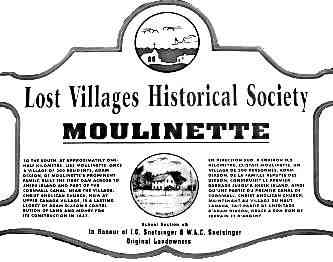
Two kilometers west of Mille Roches at the crest of Steve’s Hill (named after Stephen Forsyth) on Highway #2 was the community of Moulinette, a village of 311 inhabitants at the time of the Hydro and Seaway projects of the 1950s.
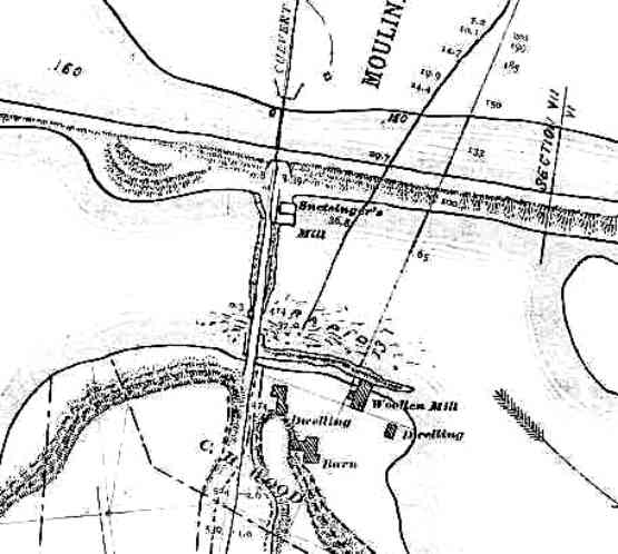
As with Mille Roches, the exact origin of the name of the village may never be known. The name Moulinette is of French origin meaning “little mill” although two theories exist for the translation. The translation might refer to the variety of mills, shingle, saw, grist and woolen, which developed at this site in the early 1800s, harnessing power from the river with a small dam or weir, the remains of which have being verified by divers along with substantial foundations of a mill complex. As well the name may be derived from moulinet, which means “winch” in French. This may refer to the windlasses which were used by the French as they winched their boats along the rapids of the north channel of the St. Lawrence river.
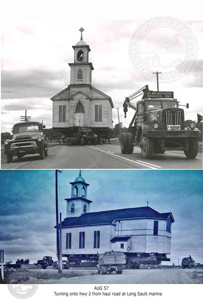
 The Dixson family was the first to settle at Moulinette and it was the ambitious Adam Dixson U.E. who left a substantial mark on the community. Having been the first person to harness the power of the St. Lawrence River at Moulinette, he made his fortune in mercantile and milling activities in the village. With his financial resources he was the driving force behind the construction of Christ Anglican Church at Moulinette in 1837. Along with large amounts of his own money, he provided the design plans and helped raise funds for the church’s construction. Christ Anglican Church was moved to Upper Canada Village, a monument to the generosity of Adam Dixson. The funeral for Adam Dixson, who died on May 9, 1837, was held in the church before its completion in that year.
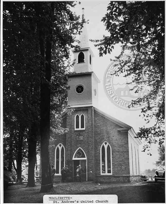
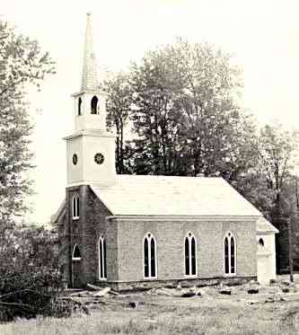
Another church with a prominent location in the village, was the Moulinette Methodist Church, later to become St. Andrew’s United Church in 1925. Construction on this church commenced in 1834 on land given to the congregation by Rev. Stephen Brownell. In 1871 alterations were made to the original structure and a steeple was added.
Unlike Mille Roches to the east, Moulinette developed as a strip community hugging Highway #2 and the old Cornwall Canal. Around 1910, John G. Snetsinger, of Loyalist stock and Member of Parliament for Stormont County, lobbied the federal government for a railway station at Moulinette. He was successful in his endeavours, for a small station was construction along the Grand Truck Railway line on the northern outskirts of the village. Today, this station is a museum building at the Lost Villages Museum site.

John G. Snetsinger established a mercantile business in the heart of Moulinette, and his old store provided service to customers until its destruction at the time of the Hydro and Seaway projects of the 1950s.
THE LOYALIST SETTLERS OF MOULINETTE
James Forsyth was a Corporal in the King’s Royal Regiment of New York. He settled on Lot No. 30, Royal Township #2, (Cornwall Township) in 1784, with his wife and two daughters.
Jacob Summers was a Corporal in the First Battalion of the King’s Royal Regiment of New York, Captain John McDonell’s Company, in 1777. He was a Light Infantryman in 1781 and 1782, and was appointed Corporal of same in 1783. Although drawing a lot in Royal Township #1, (Charlottenburg Township), he was on Lot #30, Concession #1, Township of Cornwall, in 1786.
Barnabus Spencer was born in America in 1761 and his occupation was farming. He enlisted in the King’s Royal Regiment of New York on August 15, 1778. He was a Sergeant in Captain Joseph Anderson’s Company, First Battalion, in 1781 and 1782, and was a Corporal in the Light Infantry in 1783. In 1786, Sergeant Spencer had settled on the east 1/2 of Lot 31, Royal Township #2, (Cornwall Township).
John Connolly was born in Ireland and enlisted in the First Battalion of the King’s Royal Regiment of New York on November 16, 1781. On that date he was ranked as Ensign, and on November 15, 1782, he was Ensign in Captain Patrick Daly’s Company.
Sir John Johnson, Knight and Baronet, was born in America in 1742, and enlisted in the King’s Royal Regiment of New York on June 19, 1776. In 1759, he was a Cadet in the New York Provincials, and by 1763 he was Captain. He was Major-General of the Northern District, New York Militia, in 1776. He was appointed Lieutenant-Colonel and Captain of the First Battalion of the King’s Royal Regiment of New York on June 19, 1776, and of the Second Battalion on June 21, 1780. He attained his highest rank as Brigadier-General on October 1, 1782. By 1784, he had acquired lots at Cataraqui, Montreal and Royal Township #1. By 1784, he had married Mary (Polly) Watts and was the father of four sons and one daughter. On March 14, 1782, Johnson was appointed Superintendent and Inspector-General of Indian Affairs and on May 17, 1784, he was appointed Superintendent-General of Refugee Loyalists.
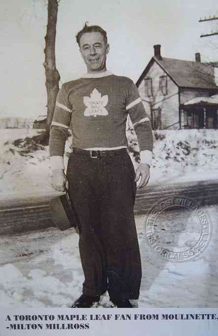
BUSINESSES
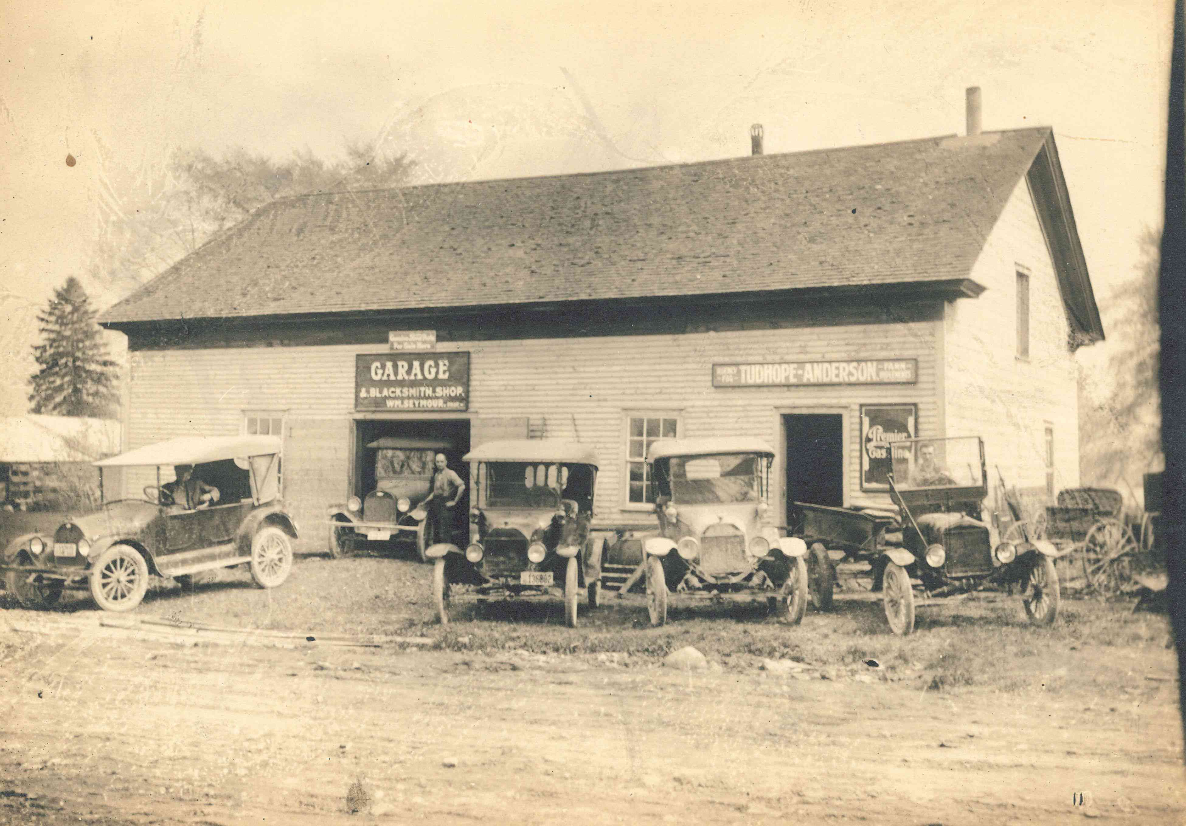
William (Bill) Seymour’s Blacksmith Shop & Garage c. 1930s
Courtesy of Seymour Family
The Daily Standard-Freeholder
Cornwall, ON December 14, 1948
Recall Days When Bergin’s Lake Known As “Sny” River
(Contributed) [Possibly by Elburn Lindsay Pitts, of Sheek Island. He often contributed little items and was often mentioned in the newspaper, ie first of the season and last of the season to cross the ice of Bergin Lake to Mille Roches, &c.]
To many residents of Cornwall Township and especially those of the Moulinette-Mille Roches area, the present-day appearance of the north branch of the St. Lawrence River, which separates Sheek Island from the main land, known as Bergin Lake, differs very much in depth and appearance from what it did 50 or more years ago.
To the writer, who was a resident of that district for many years, it would seem that a description of the River, as it was in those days, might interest a number of the readers of the Daily Standard-Freeholder.
At that time, this branch of the river was known as the “Sny,” but later was known, but seldom called, Bergin’s Lake, in honor of the late Dr. Bergin, who represented Cornwall and Stormont in the Federal House, and who sponsored this development. Fortunately, he lived to see its completion.
Mere Trickle
In midsummer, this stream was a mere trickle and in a particularly dry summer one could almost cross it dry shod. The only access to Sheek Island was through a culvert at Moulinette, which carried the roadway under the canal and emerged on a bridge. This bridge was perhaps 300 yards long and connected with Sheek Island on the farm now occupied by Roy Raymond. The bridge in question was a shaky affair, made of timber and stones loosely laid and was eventually replaced by a fine swing bridge at Mille Roches. At the north end of this bridge, just as one came through the culvert, stood the grist mill owned by the late J. G. Snetsinger and operated by William Ellis, of Moulinette. At the south, or island end of the bridge, was the property of the late C. H. Wood, father of Mrs. Alex Brown, of Dickinson’s Landing. This property consisted of a dwelling house, farm buildings and a woollen mill which Mr. Wood operated for many years. These buildings were all torn down and moved elsewhere and their sites are now under 30 feet of water.
In the winter of 1888-89, the writer remembers as a boy standing on the canal bank on a bitter February day, watching the back water creep up foot by foot on this grist mill. Huge cakes of ice already had broken a hole in the east side large enough to drive a pair of horses through. The lower story was flooded to the ceiling with floating ice cakes and swirling water and it looked as though the mill would topple over at any moment. However the flood subsided, the mill was later repaired and ran for many more years. The back water of that winter made an all-time record and did considerable damage to Cornwall and district. [He may be referring to the well-documented flood of January 18, 1887 which flooded a large section of the Town of Cornwall.]
At Mille Roches, another stone culvert carried the road into the village of Old Mille Roches. These culverts are still standing, although submerged by the filling in of Bergin’s Lake. They were built during the construction of the canal in the early 30’s of the last century.
 A year or so previous to 1896, Samuel Moss, then a well-known farmer of Sheek Island, sowed a large tract of buckwheat on the dry river bottom. This buckwheat grew shoulder high and yielded a fine crop. This tract was about opposite the property of Bert Mattice and Mr. Moss’ farm of that day is now occupied by Herb Raymond.
To people of middle age it would be hard indeed to visualize the river as it was in those far off days. However all this is changed. At the opening of navigation in the Spring of 1896, the water was turned in and in place of the once shallow “Sny,” overgrown with wire grass and cat-tails, came the beautiful Bergin Lake of today.
The labor[sic] of many years had been finished and the promises of many successive governments had been fulfilled, owing very largely to the untiring efforts and persistence of the late Dr. Bergin.
Should the St. Lawrence Seaway go through, this district will be submerged under 60 or more feet of water.
A really big elm.
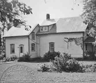
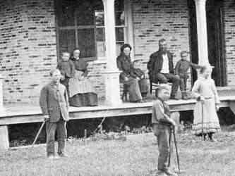
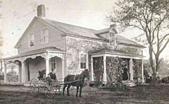
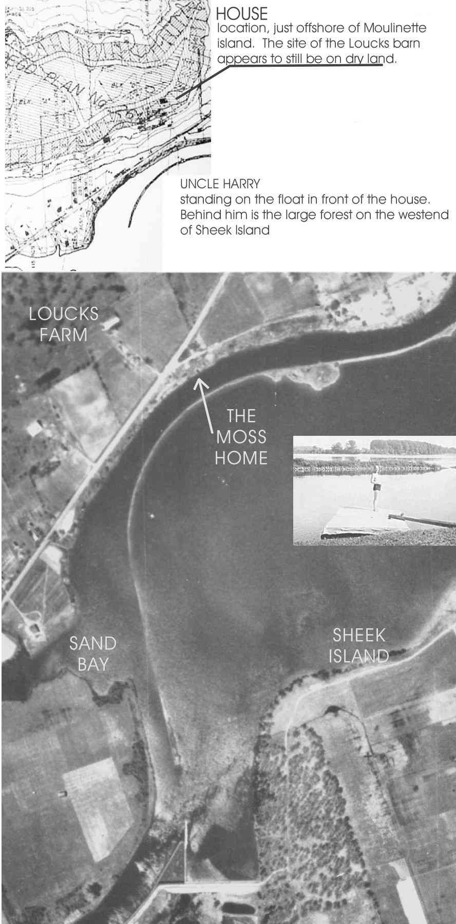
THE MOSS RESIDENCE
(Highway #2, west of Moulinette, before Sand Bay)
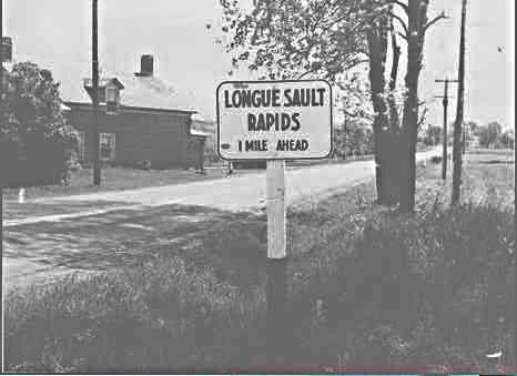 This information comes from emails received from Ms. Carole Main after she saw the posted picture of the sign on highway #2, “Longue Sault Rapids, 1 mile” on the Mystery page. The exact location of the sign was a mystery, was it 1 mile east or west of Rapids Point and which house was that in the photo? Below are quotes by Ms. Carole Main of a place west of Moulinette and just east of Sand Bay, now not as forgotten.
”The house with the one-mile sign to the Longue Sault Rapids was the Moss residence, I lived there with my grandfather Robb Moss and Grandmother Lena Robertson Moss. The house was originally an inn; each of the 4 bedrooms upstairs had 3 glassless windows at the top to keep us warm in the winter. The house had two fireplaces in the basement which indicated that the family lived there for the first couple of winters while the house was being built. It was made of stone blocks; the west and north sides had a gray metal covering it. (The stones were not as wide on those sides..you could tell by the narrower window sills.) The dining room windows had very wide sills about two feet. There were two fireplaces ..one in the dining room which was used in winter and the other in the living room which was covered over”.
“Hwy 2 was very close to the house and in winter we frequently had hitchhikers knock at the door. I would run upstairs and put on my grandfather’s shoes (He passed away when I was in 7th grade) and walk around the hardwood floors. Then my grandmother would let the hitchhiker come in to get warm or give him something hot to drink and send him on his way”.
“There was a gravel road right in the middle of the yard which went east past two summer cottages to Bert Mattice home and the Chappel home. Bert Mattice delivered ice in the summer. He had a huge ice house near the river; in winter he cut the ice out of the river. Although he put up barricades around the huge open space my grandmother would be frantic about us falling in the water. We didn’t”.
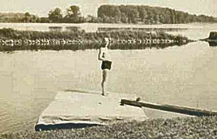
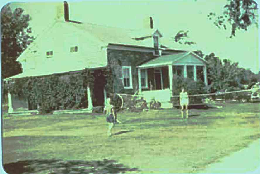 “This is the side of the Moss home away from Hwy 2., the gravel road on the right went east to Bert Mattices’ home and the Chapel home (They only came in the summer, think they lived in New York State.) I am the tall one playing badminton; can’t identify my partner”. On the river side there was a large bank with many stone steps down where we had a boathouse and a big raft to swim from.
 “As to the location of the Moss home, it is directly across from the west end of Sheek Island. The Loucks farm was across the highway up on the hill; they were the tenant farmers of my grandfather. My grandfather lived in the Stone house with his father Sam Moss and his nephew Walter Roys, a relative whose mother had died in childbirth”.
“My grandfather wasn’t cut out to be a farmer, he fought in the Boer War, he went to Klondike Gold Rush, etc. He owned quite a lot of farms and I remember one day when a tenant farmer came in to pay his rent; the farmer was moaning about the poor year and the fact that he couldn’t pay the rent. My grandfather said, ” How much money do you have in your pocket?” The farmer said, “Seventeen dollars.” My grandfather said, “Give me the $17 and take the “expletive deleted ” farm!” Luckily he didn’t give everything away. We did end up with a massive gravel pit, much of which went into the Seaway; it kept our grandmother, my sister and me quite nicely”.
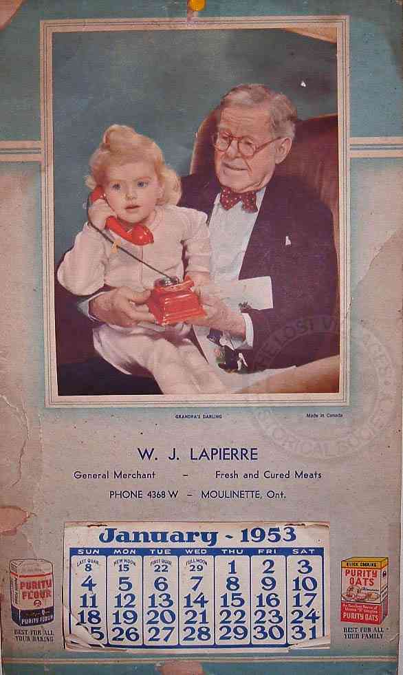
“The gravel pit (quarry) was in the 2nd or 3rd concession; think we took the road that went north across the railroad tracks at the corner where Lapierre’s Store was, the Pool Hall and Mrs. Forsythes Candy Store. There were no other buildings near the gravel pit. When we lived in Quebec (Pincourt on Ile Perrot) we used to come to Cornwall on the week-ends to swim in the gravel pit. It was deep and very cold; our children had to have life preservers.
Lapierre’s Store
“The family lived on the second floor and there was a porch across the front. When my father returned from WWII he worked in the butcher shop there. He built a refrigerated box, might have been an ice box which he put in the back of his Hudson truck. There were only 2 of them in the area. In the summer he had a route along the river where all the summer people stayed in cottages. Most of them had only one vehicle so the wife and children would be stuck without transportation…many of those people came from Ottawa”.
”My grandfather chose Mrs. Ellis as the principal much the the indignation of the other board members. She ruled harshly but everyone who came out of there could read write and show up!”
FOOTNOTES
1— “ Sam Moss purchased the beautiful Victorian sofa from Dr.Capt Bergin and our oldest granddaughter has it now in Grover Beach (San Luis Obispo area.) Originally it was blue with small flowers. Next it was maroon with little yellow flowers. Gramma and Granpa did the recovering. Next it was gold to match our home in Gig Harbor. Robb and I did it that time. (Everything was a warm color since it seemed to be cold all year.)”
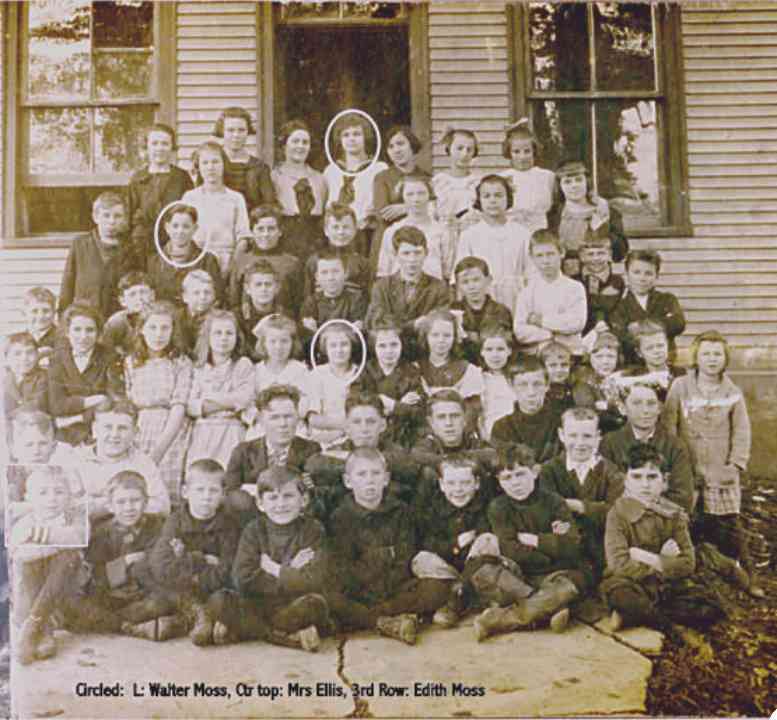
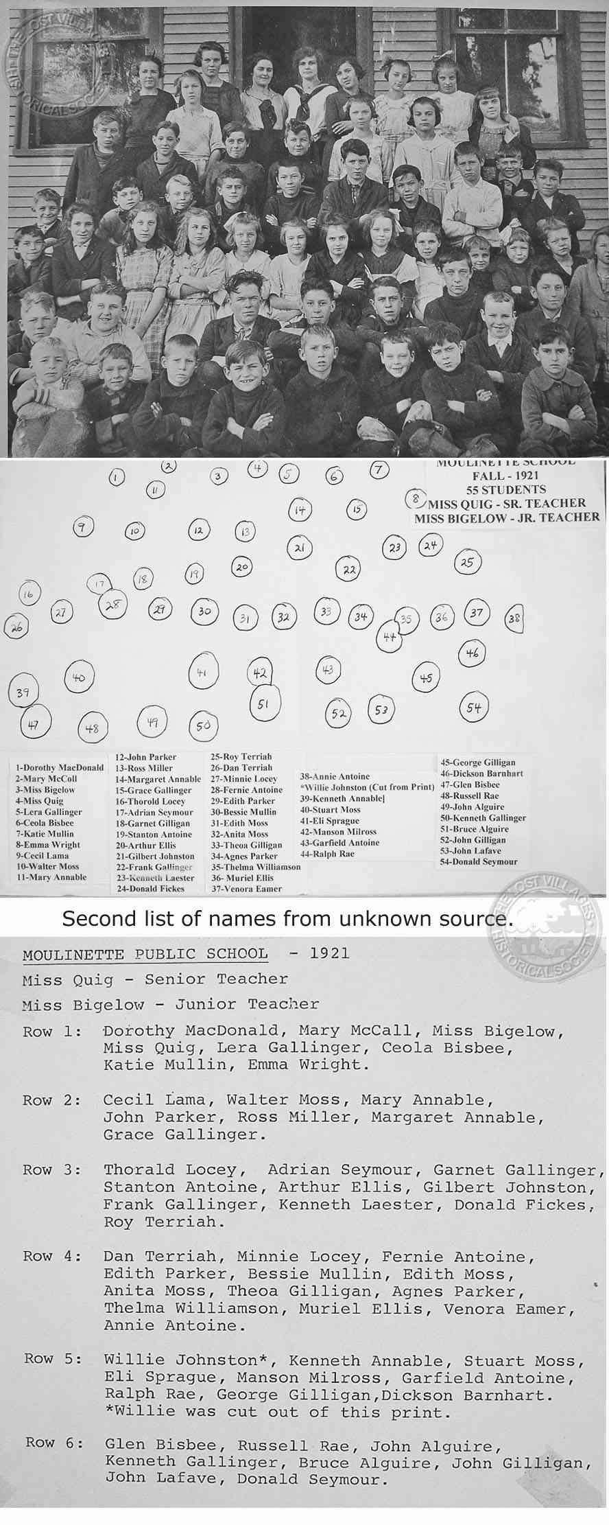
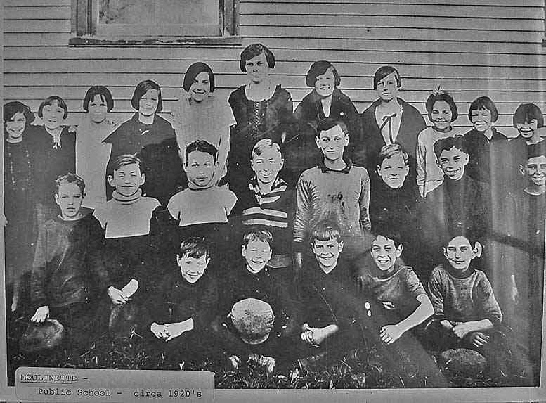
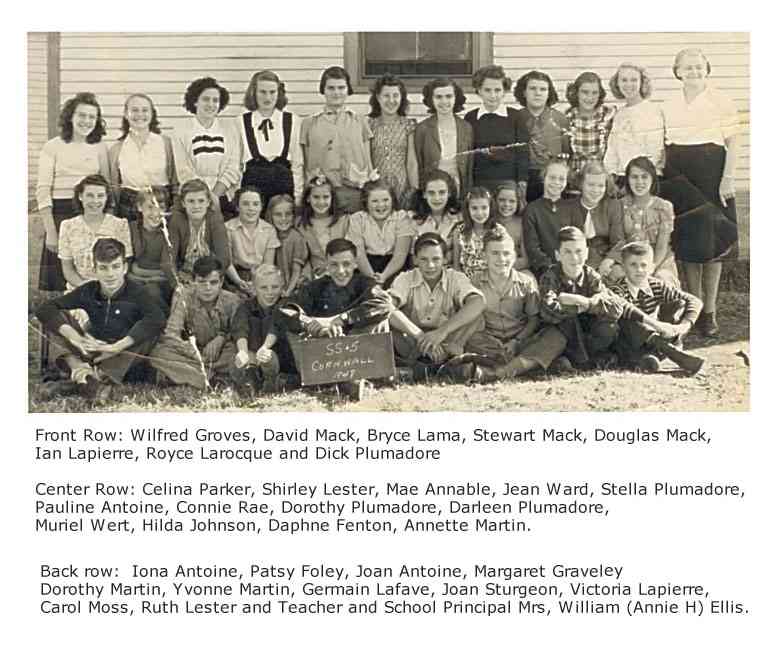
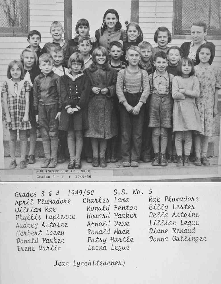
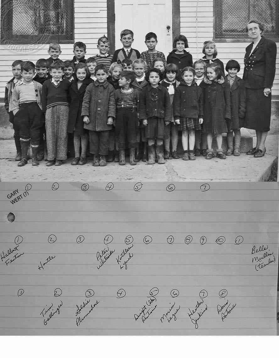
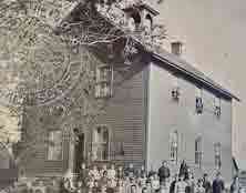
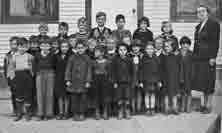
SS#5
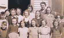
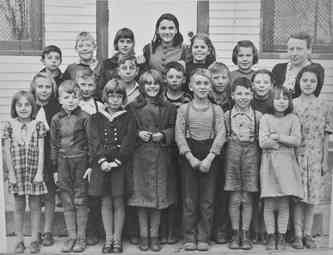
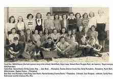
Pictures, dates, names etc., aren’t showing up together and the sorting continues as more material is being gathered, sent in and uploaded.
Some of the photos have partial lists of names on the reverse side, these will be posted with the full size photo and there are also multiple lists for the same photo but the lists don’t always have the same names. Therefore it’s going to be a majority rules but all the submissions will be posted.
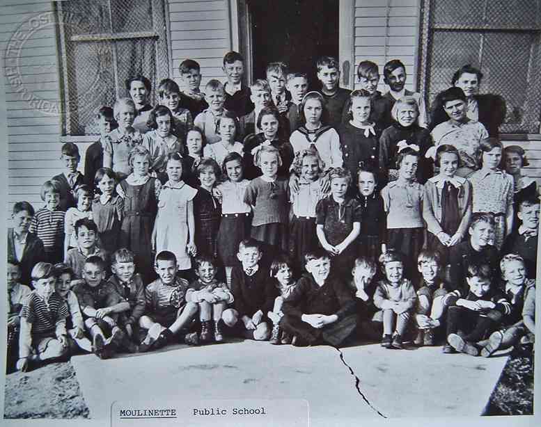
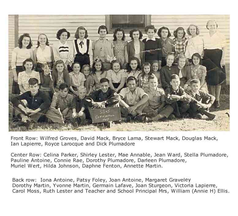
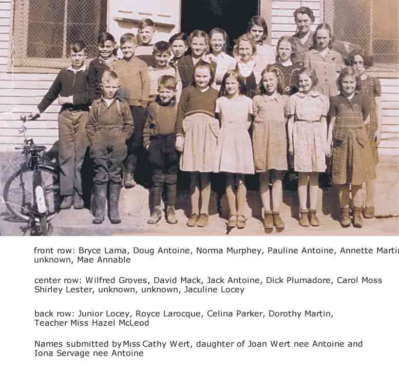


FACES AND PLACES

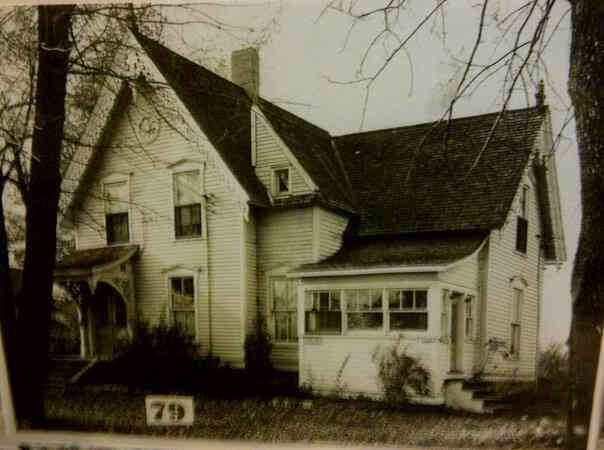
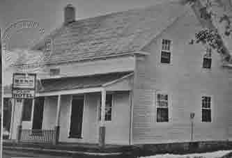
This house was #81, and the 91st house moved to Long Sault. It was moved on October 29, 1956, and placed on the new foundation on November 1, 1956.