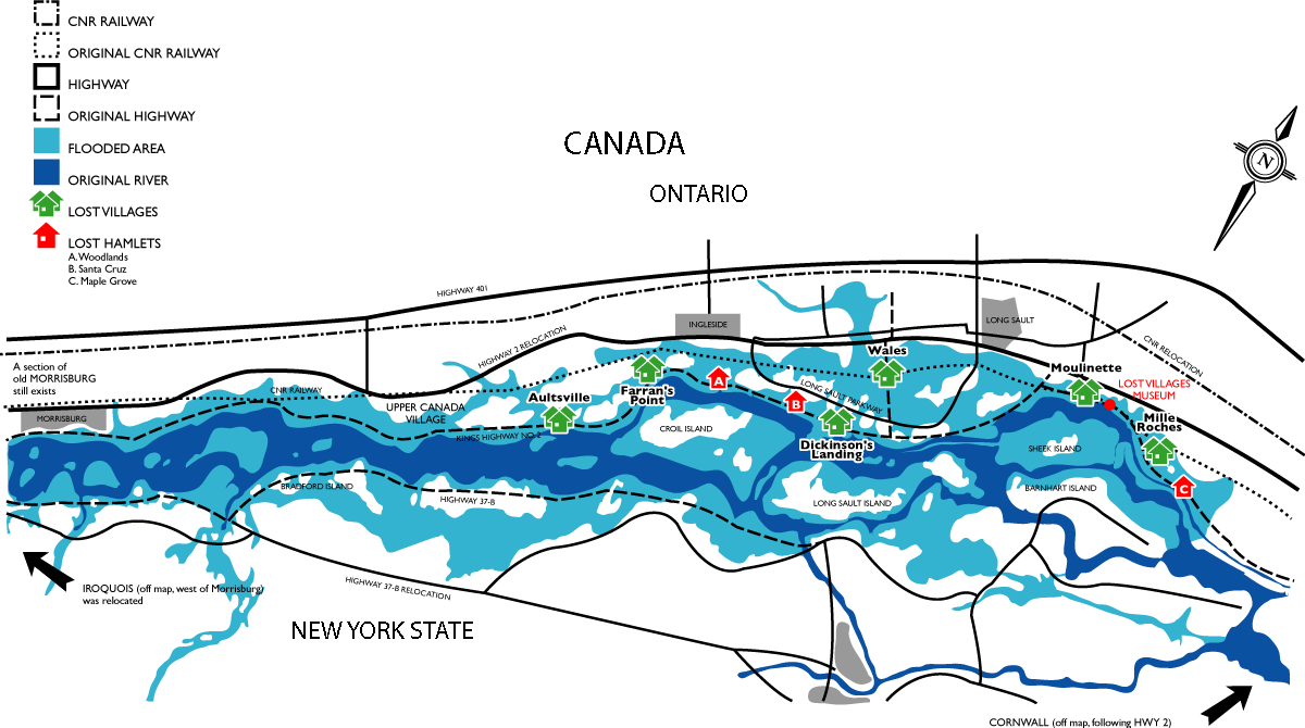
This map displays where the original villages and hamlets were located before Inundation Day, July 1, 1958. The dark blue indicates the original St. Lawrence River; the lighter blue indicates the river after flooding. Aultsville Dickinson’s Landing Farran’s Point Iroquois Maple Grove Mille Roches Morrisburg Moulinette Santa Cruz Sheek/Sheik Island Wales Woodlands Aultsville Dickinson’s Landing Farran’s Point Iroquois Maple Grove Mille Roches Morrisburg Moulinette Santa Cruz Sheek/Sheik Island Wales Woodlands